Long-range shooting range
Steel Valley Long Range
A 1000 m shooting lane for long-range shooters from all over Europe.
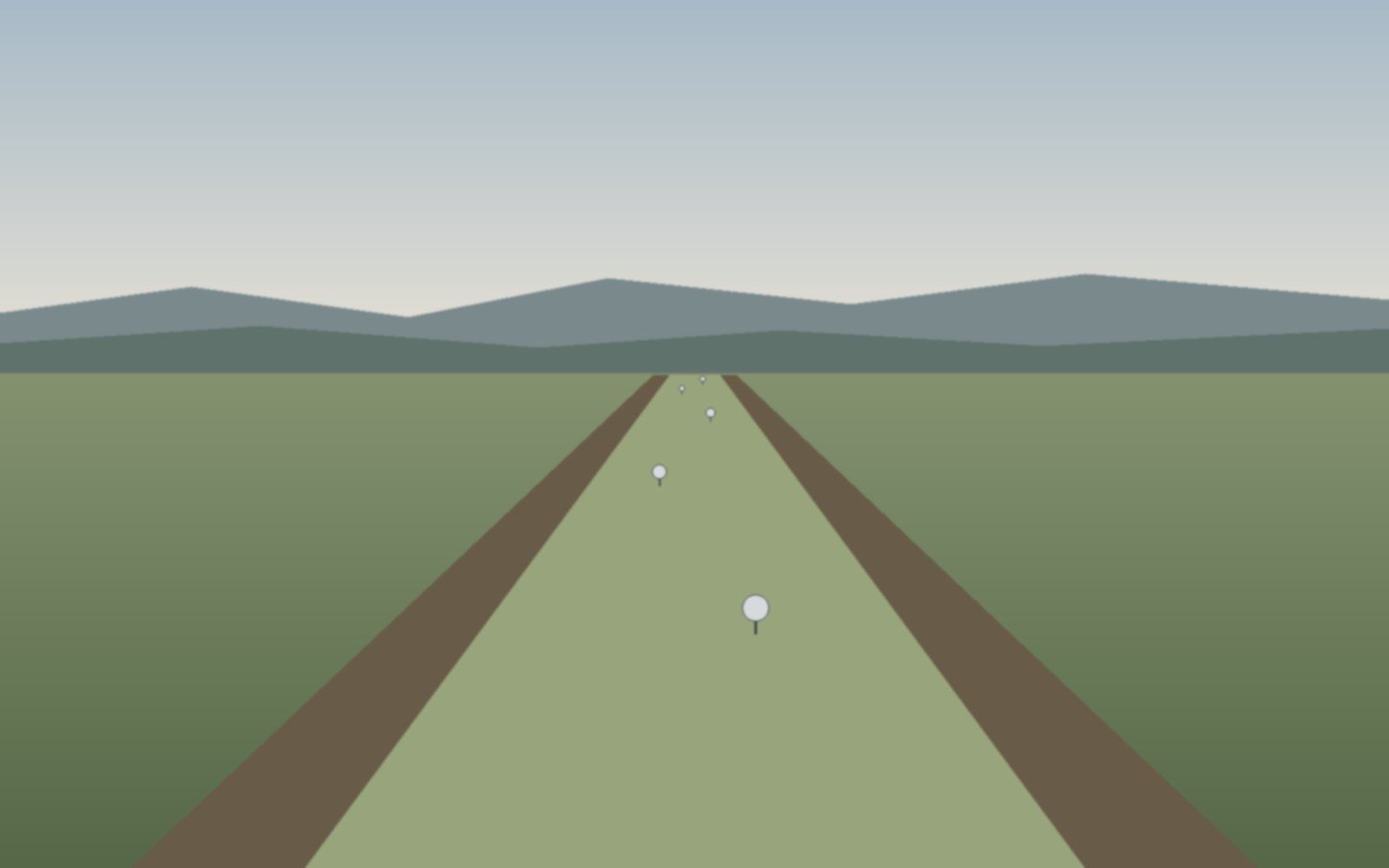
1000 m lane
About the range
Steel Valley Long Range is a shooting range built for long-range shooting: a 1000-metre lane and a target field with steel targets.
Steel targets placed at various distances allow training and competitions over the full length of the lane. An additional 100-metre lane is also available. Electronic targets will be available in the future as well.
- shooting lane length
- 1000 m
- zeroing lane
- 100 m
- across the entire target field
- Steel
Disciplines
The 1000 m lane and steel targets support a range of long-range shooting disciplines. A moving target and electronic targets will also be available soon.
Precision Rifle (PRS)
Precision shooting from various positions and supports at steel targets over changing distances, under time pressure.
NRL Hunter
NRL Hunter is a field-shooting sport built around realistic hunting scenarios. Steel targets at unknown distances are engaged from natural field positions, using the very same skills that make a capable, ethical hunter.
Sharpshooter Challenge
A military approach to long-range shooting. Shooting at known and unknown distances, moving targets, and a variety of positions adapted to the terrain.
F-Class
Precision prone shooting from a rest at long distances.
Training and courses
Sessions for shooters who want to start or develop their long-range shooting skills in any form. Best-in-class instructors.
Range layout
A simplified plan of the range showing the layout of the steel targets. The firing line is at the bottom; the targets lie downrange.
Legend
- square
- circle
- rhombus
- rectangle
- silhouette
- bust
- other
| Label | Label | Shape | Distance | Size |
|---|---|---|---|---|
| V1315 m | V1 | square | 315 m | side 15 cm |
| S1320 m | S1 | square | 320 m | side 15 cm |
| S2320 m | S2 | square | 320 m | side 20 cm |
| S3320 m | S3 | square | 320 m | side 20 cm |
| I1366 m | I1 | square | 366 m | side 20 cm |
| I2366 m | I2 | square | 366 m | side 20 cm |
| H1366 m | H1 | square | 366 m | side 20 cm |
| H2366 m | H2 | square | 366 m | side 15 cm |
| W1395 m | W1 | circle | 395 m | diameter 30 cm |
| W2395 m | W2 | square | 395 m | side 20 cm |
| U1430 m | U1 | square | 430 m | side 25 cm |
| U2430 m | U2 | square | 430 m | side 20 cm |
| U3430 m | U3 | square | 430 m | side 15 cm |
| U4430 m | U4 | square | 430 m | side 10 cm |
| J1457 m | J1 | square | 457 m | side 30 cm |
| J2457 m | J2 | square | 457 m | side 20 cm |
| K1492 m | K1 | square | 492 m | side 20 cm |
| Q1510 m | Q1 | square | 510 m | side 30 cm |
| B1570 m | B1 | square | 570 m | side 50 cm |
| P1600 m | P1 | square | 600 m | side 40 cm |
| R1650 m | R1 | square | 650 m | side 50 cm |
| N1700 m | N1 | square | 700 m | side 40 cm |
| E1760 m | E1 | square | 760 m | side 50 cm |
| E2760 m | E2 | square | 760 m | side 40 cm |
| E3760 m | E3 | square | 760 m | side 25 cm |
| E4760 m | E4 | square | 760 m | side 20 cm |
| C1800 m | C1 | rhombus | 800 m | side 30 cm |
| L1850 m | L1 | square | 850 m | side 55 cm |
| X1900 m | X1 | square | 900 m | side 55 cm |
| F11,000 m | F1 | square | 1,000 m | side 65 cm |
| A1400 m | A1 | rectangle | 400 m | 50 × 100 cm (W × H) |
| Y1980 m | Y1 | silhouette | 980 m | height 180 cm |
| M1730 m | M1 | bust | 730 m | height 50 cm |
| Z1550 m | Z1 | other | 550 m | Cel przykładowy, 60 × 60 cm (W × H) |
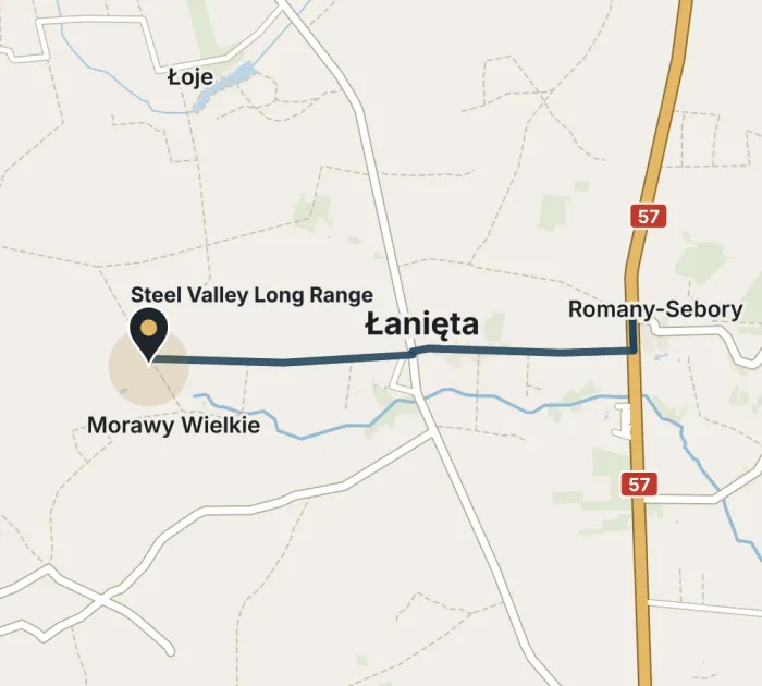
Location and directions
- Address
- Morawy Wielkie 06-316
- GPS coordinates
- 53.104351° N, 20.796571° E
Best way to get here
The only access road to the range runs through Łanięta.
Accommodation and attractions
Within 50 km of the range there are hotels and inns as well as places worth visiting in northern Masovia and the Kurpie region.
Below is a selection, nearest first. Distances are measured in a straight line from the range; the road route is longer.
Where to stay
Hotel Sebory
Hotel with the Zajazd Sebory restaurant, a bar and a private beach; bicycle rental and mini golf on site.
View on Booking.com: Hotel SeboryHotel Millennium
A small hotel in Przasnysz with family rooms, free parking and Wi-Fi.
View on Booking.com: Hotel MillenniumDwór Karwacz
A manor-style guesthouse with a restaurant, garden, tennis court and bicycles for guests.
View on Booking.com: Dwór KarwaczHotel Atena
A hotel with a spa and wellness area in a quiet part of Ciechanów; free parking.
View on Booking.com: Hotel AtenaHotel Korona
A hotel with a restaurant, bar and terrace in Ciechanów; free parking.
View on Booking.com: Hotel KoronaHotel Mława
A hotel next to the MOSiR sports facilities in Mława, with a restaurant and 24-hour reception; swimming pool nearby.
View on Booking.com: Hotel MławaHotel & Restauracja Wróblewscy
A hotel with a restaurant, bar and garden; free Wi-Fi throughout.
View on Booking.com: Hotel & Restauracja WróblewscyGospoda Pazibroda
An inn with a restaurant, bar, garden and children's playground; free bicycles for guests.
View on Booking.com: Gospoda PazibrodaHotelik ze śniadaniami „KUR”
A small hotel with a restaurant and bar in the heart of the Kurpie region; free parking and Wi-Fi.
View on Booking.com: Hotelik ze śniadaniami „KUR”
Nearby attractions
Muzeum Historyczne w Przasnyszu
The Historical Museum in the old town hall and the Gothic Bernardine (now Passionist) monastery, one of the largest in Poland.
Sanktuarium św. Stanisława Kostki
Birthplace of St Stanislaus Kostka; a neo-Gothic church with the saint's relics, visited by pilgrims from Poland and abroad.
Zamek Książąt Mazowieckich
A Gothic castle from the turn of the 14th and 15th centuries on the Łydynia river, with an exhibition on the independent Duchy of Masovia.
Website: Zamek Książąt MazowieckichMuzeum Ziemi Zawkrzeńskiej
A regional museum with the bilingual exhibition “Battle of Mława 1939”; remains of the Mława Position fortifications nearby.
Website: Muzeum Ziemi ZawkrzeńskiejMuzeum Romantyzmu
The Krasiński family's neo-Gothic little castle in a landscape park, with mementos of the poet Zygmunt Krasiński.
Website: Muzeum RomantyzmuZagroda Kurpiowska
An open-air museum of traditional wooden architecture of the Kurpie Forest; the Kurpie Wedding re-enactment is held here in June.
Website: Zagroda Kurpiowska